In today's ever-evolving technological landscape, artificial intelligence (AI), particularly deep learning techniques, have found their way into numerous scientific domains. One such captivating application lies within the realm of aerial surveys—a field undergoing revolutionary transformations thanks to recent breakthroughs like the "Learnable Earth Parser." Developed by researchers striving towards unifying data understanding and three-dimensional (3D) scene analysis in large aerial scan datasets, this innovative technique promises a paradigm shift in how we process geospatial data. Let us delve deeper into its intriguing facets.
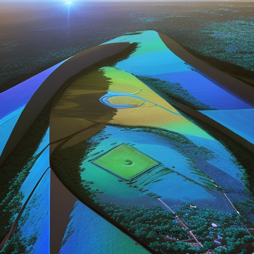
The **Learnable Earth Parser** stands as an unprecedented accomplishment in the pursuit of automating the dissection of massive 3D points clouds derived from aerial imagery. In contrast to traditional methods heavily reliant upon human supervision or laborious manual annotation processes, this groundbreaking framework operates independently without any prior knowledge specific to individual scenes. Consequently, it offers a more efficient alternative for interpreting complicated spatial environments encountered during aerial reconnaissance missions.
At the heart of this algorithm resides a sophisticated probabilistic reconstruction model. Designed meticulously, this system deconstructs raw 3D inputs into manageably sized sets of predetermined yet adaptive geometric archetypes – popularly termed "prototypical" structures. By adopting a learnable approach, these abstract models effectively capture common features across various terrains, allowing seamless reconstructions devoid of misleading idiosyncrasies often associated with manually crafted templates.
Upon implementing the proposed strategy over extensive aerial Light Detection And Ranging (LiDAR) scans sourced from disparate circumstances, the research team observed remarkable outcomes. Not merely confining themselves to accurate decomposition but also demonstrating proficiency in performing unsupervised semantic instancing, a crucial aspect of comprehending the underlying structure of vast landscapes. These findings position the "Earth Parser" ahead of contemporary unsupervised approaches regarding both precision and interpretability.
Making strides toward democratizing accessibility, the creators behind this marvelous invention have made their source code publicly accessible alongside a dedicated dataset showcasing the impressive efficacy of their creation. With this move, they aim to catalyze further advancements in automated 3D terrain interpretation, paving the pathway for countless applications spanning remote sensing, urban planning, environmental monitoring, archaeological exploration, natural disaster response efforts...and much more!
As technology continues evolving, breakthroughs such as the "Learnable Earth Parser" open new horizons, revolutionizing the ways we perceive, analyze, and interact with the physical world around us through advanced computational means. Embracing innovation in fields like aerospace engineering, cartography, computer vision, machine learning, among others, will undoubtedly propel humanity forward on a trajectory marked by profound discoveries and enhanced understanding of our shared environment.
Source arXiv: http://arxiv.org/abs/2304.09704v2